
With tech it’s easy to stick with the features you’re familiar with. But LandInsight, like a lot of tech, is constantly changing.
And there’s a LandInsight tool you might not be familiar with:
Drawing on maps.
Let’s go through it.
What is Drawing on Maps?
It wasn’t always easy to annotate maps during your site due diligence.
Whether it was tracing over policy maps or title documents (physically or digitally), or screen grabbing from site sourcing software like LandInsight, and annotating in another program…the process was cumbersome to say the least.
But now?
You can digitally draw & annotate your maps without leaving LandInsight. And only in a matter of clicks.
How does it work?
Let’s go through how to use it:
Click the toolbar on the top right hand side of your screen.
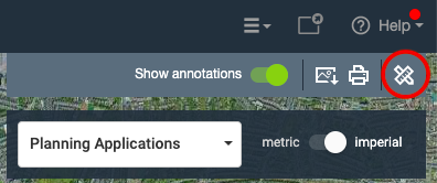
Once you’ve done this you’ll have access to the following drawing tools:
- Ruler
- Shape options
- Point of interest markers
- Text
- Line
- Pointer
How can I use this?
Apart from practising on becoming the next Picasso, you can use these tools to create your very own Site Plans, Area Plans, and Mapping Data.
It’s almost like creating your own custom map layer – right in LandInsight.
Let me explain more:
Site Plans
What are they?
A Site Plan allows you to visualise the site you’re looking to create. It’s helpful if for instance, you’re looking to combine multiple properties into one site.
How do you create them?
Once you’ve saved your site, open up the drawing on maps toolbar and select your polygon tool. Then you can draw the units of the map by clicking the points of the respective property.
Want to build out multiple units on your site? No problem.
You can copy the outline of the unit you may need more than one of. Simply click on the polygon and in the corner of the box that will appear on the right side of the screen will be an ellipsis, clicking on that will give you the option to duplicate that polygon so you can make sure all your units are the same size and shape. The image below is an example of this.

This is useful as it allows you to quickly build a custom site plan which can help with your due diligence and communicating with partners and stakeholders.
Area Plans
What are they?
Whereas a Site Plan is a visualisation of the site you’re looking to develop, an Area Plan is a zoomed out visualisation of the neighbourhood or area you’re considering to develop in.
How to create them
Once you’ve saved your site, you can use the text tool and point of interest marker to label different parts of an area.
The image below is a visual example of this.

Why is this useful?
Saving sites is a great habit when using LandInsight, but over time it can start to get tricky remembering exactly why you have saved a site, or why a specific parcel of land has been highlighted on the map.
Area Plans help you to remember the reasons why you decided to save a site.
You can also use them to label local features, amenities, or services, that can help you when assessing a site.
Mapping Data
What is it?
The process of attaching specific sets of data onto the map.
How to create it
Load the data you want to map, in this example we’ve chosen SHLAA, and choose your area of interest. Once you’ve saved your site, open up the drawing on maps toolbar and select your polygon tool again.
Then select your text tool and copy or write whichever data is relevant for you.
You can switch between different layers and add any other relevant data. E.g. comps or planning application references – you’re only limited by your needs and your imagination
Below is a visual example of Mapping Data.

Why is this useful?
As you save up a lot of sites, it can become tricky navigating through different layers to find the data you want. Mapping data allows you to quickly scan and pick up the information you want, for the areas you’re interested in.
Want to learn more?
If you're already a LandInsight customer get in touch with your designated Customer Success Manager to find out more information. If you're not a customer, click the link below to see our Tutorials page. This will demonstrate how our features can benefit you.
